Blog · how-to · 7min readmin Lesezeitmin de leitura
Stockpile Measurement Methods: 6 Ways to Measure Bulk VolumeVolumenmessung von Schüttgut: 6 Methoden im ehrlichen VergleichMétodos de Medição de Pilhas: 6 Formas de Medir Volume a Granel
03 Aug 2026 03. August 2026 03 de agosto de 2026 · Sachtleben Technology
Anyone specifying stockpile or bulk volume measurement runs into six fundamentally different methods — and six vendor camps, each declaring theirs the only sensible one. We build LiDAR systems ourselves, and we still have a stake in an honest comparison: a customer on the wrong technology is an unhappy customer two years later. Here is the overview we wish someone had handed us at the start.
The starting question is never "which technology" but "which task". Distinguish three cases: the point-in-time inventory (quarterly or yearly, high accuracy, audit-grade), continuous stock monitoring (every shift, every hour, live into the ERP) and process measurement (volume flow on the belt, fill level in the bunker, real-time into the control system). Most bad purchases happen because a technology from one case gets sold into another.
This is what we build: OWL EYE® STOCKPILE — continuous bulk volume measurement with stationary 3D-LiDAR. ±1 % accuracy, 24/7, every pile live in the dashboard — no drone, no surveyor, no downtime.
→ See the solution: OWL EYE® STOCKPILE — real-time stockpile monitoring
1. Manual survey (total station, GNSS walk, pacing). The classic for the annual inventory. A surveyor walks the pile or shoots profiles.
- Strengths: No capital outlay, long established, accepted by auditors. For two piles once a year, hard to beat.
- Weaknesses: Accuracy depends on the measuring technique: pacing and simple profile shots drift 5–15% on irregular, fissured piles — with modern 3D measurement, ±1% is the standard: a terrestrial laser scanner captures the whole pile from a few setup positions with a clear line of sight — elevated at the edge, from above or, where the geometry demands it, from the pile itself (that is how we run our bulk inventory service). It remains a point-in-time survey, though: results arrive days later, and between two surveys the stock is invisible.
- Fits when: few piles, rare measurement, no live requirement.
2. Drone photogrammetry / drone LiDAR. One flight produces a 3D model of the whole yard.
- Strengths: Large outdoor areas in a single pass, 1–3% accuracy with a good ground-control network, results everyone understands at a glance.
- Weaknesses: Weather-dependent (photogrammetry additionally needs daylight), practically unusable inside buildings, needs a trained pilot and, depending on airspace, flight approval. Most importantly: it remains a point-in-time measurement — between two flights, nobody sees the stock, and every flight costs again. Measuring weekly instead of quarterly multiplies the recurring cost.
- Fits when: large outdoor yard, monthly or quarterly inventory is enough. The full comparison: LiDAR vs. drone.
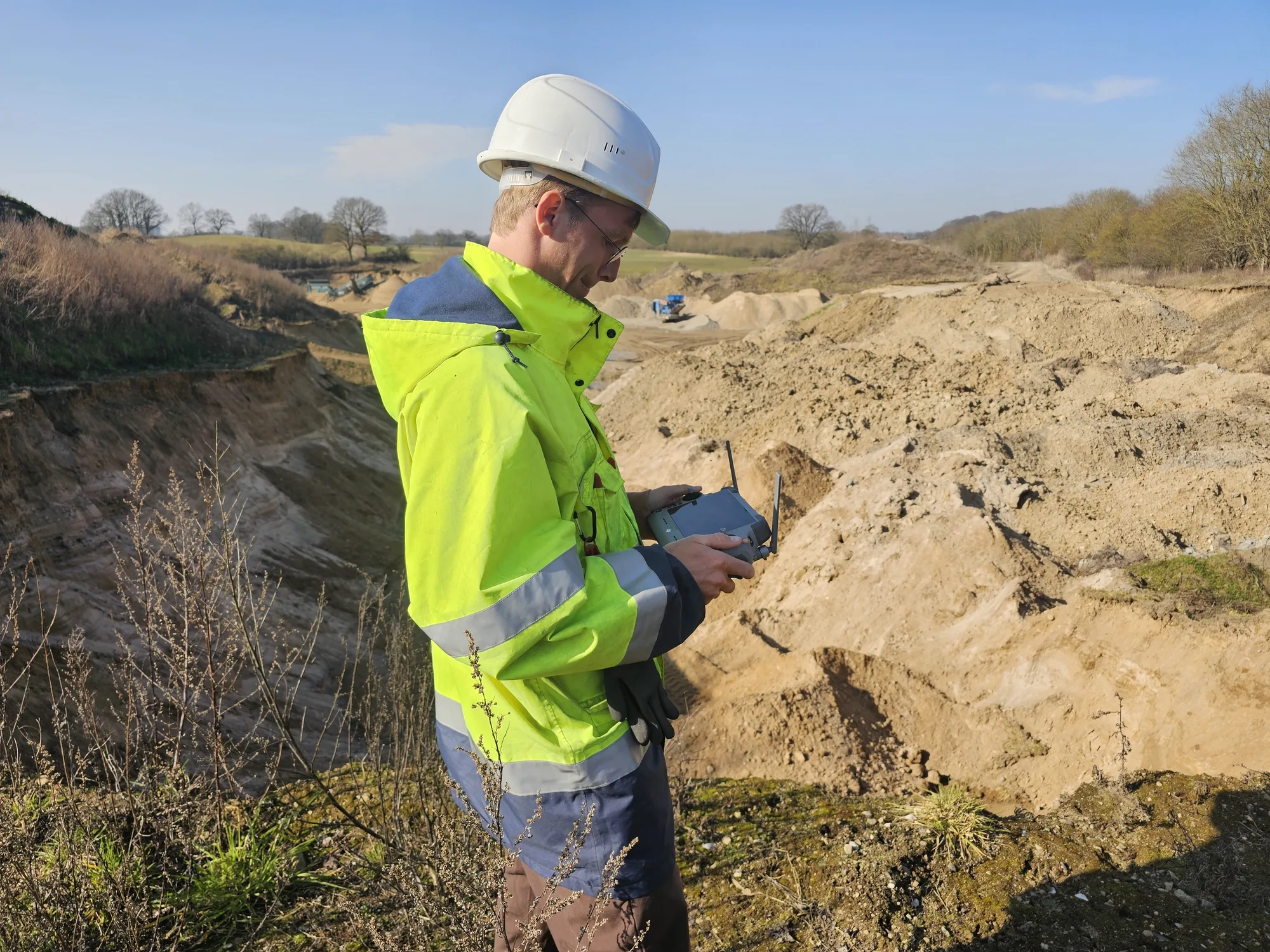
We offer this as a service: drone surveying & aerial survey — across the entire DACH region, with local pilots. Flight incl. processing typically €1,200–2,500, fixed-price quote within two working days.
→ To the service: drone surveying & stockpile survey by drone
3. Ultrasonic. The cheapest level sensor — one point, one echo, one distance.
- Strengths: Price. Entirely sufficient for a small silo with a flat material surface.
- Weaknesses: A single point says almost nothing about volume once cones, bridging or build-up appear. Dust attenuates the echo; temperature layering distorts the time-of-flight reading. Range is limited.
- Fits when: small silos, homogeneous material, a point-level alarm rather than a true volume is required.
4. Radar (1D and 3D). The rugged choice for point or surface measurement — radar penetrates dust with almost no signal loss.
- Strengths: Largely unaffected by dust, vapour and build-up on the antenna. 1D radar is the standard for single silo levels; 3D radar systems produce coarse surface profiles even in extremely dusty bunkers.
- Weaknesses: Spatial resolution. A 3D radar delivers a few dozen measurement points per surface; a 3D LiDAR resolves the same surface with hundreds of thousands. For zone balances, FIFO aging or block models, radar resolution is not enough. The detailed comparison: LiDAR vs. radar.
- Fits when: extreme dust (active filling in a closed silo), simple geometry, a fill level rather than a block model.
The 3D alternative to the point probe: OWL EYE® BUNKERS & FEEDERS — 3D level measurement for silos & bunkers: the complete surface instead of a single height, ±1 %, contactless and dust-resilient.
→ See the solution: 3D level measurement for silos & bunkers
5. Belt scale. Strictly a mass measurement, not a volume measurement — but the benchmark it all gets compared against in every process-measurement tender.
- Strengths: Direct mass measurement, certifiable — for custody-transfer weighing often the only permissible solution.
- Weaknesses: Drift from material build-up, mechanical wear, calibration downtime. And it only measures throughput at one point — it never sees the stock in the yard.
- Fits when: certified billing weight is mandatory. When adding or switching pays off: LiDAR vs. belt scale.
The wear-free alternative to the belt scale: OWL EYE® VOLUME FLOW — conveyor volume flow measurement: ±1 %, no moving parts, belt load and height profile included.
6. Stationary 3D LiDAR. Permanently mounted sensors above the pile, the belt or inside the bunker — continuous point clouds, turned into volume, tonnage and a block model in real time. How it works step by step: LiDAR stockpile measurement in five steps.
- Strengths: The only method combining 24/7 operation with high spatial resolution: ±1% volume accuracy, every pile individually, zones and aging (FIFO) traceable, values delivered via REST, OPC UA or a SAP interface straight into the ERP. No recurring cost per measurement — the marginal cost of one more scan is zero.
- Weaknesses: Upfront investment (sensors plus installation), and sensors need line of sight — under permanent heavy dust right at the discharge point, radar wins. For a single annual inventory a fixed installation is oversized; there, a terrestrial laser scan as a service is the more economical answer.
- Fits when: the stock figure is needed continuously — inventory monitoring, process control, load-out, FIFO. That is exactly what we built OWL EYE® STOCKPILE (piles) and OWL EYE® VOLUME FLOW (conveyors) for.
The decision logic in four questions.
- How often do you need the figure? Once a year → surveyor or scan service. Monthly, outdoors → drone. Hourly or live → stationary LiDAR.
- Indoors or outdoors? Inside buildings, drone and GNSS are largely ruled out; stationary LiDAR and terrestrial scanning remain.
- How much dust? Dust only while filling → LiDAR with timed measurement windows. Permanent dense dust → radar, accepting the resolution trade-off.
- Is a level enough, or do you need a volume? A single point is not a volume. As soon as cones, multiple zones or aging matter, there is no way around full-surface 3D measurement.
Our honest bottom line. There is no best method — only the right one per task. For the rare point-in-time inventory, a fixed LiDAR installation is too much; for continuous stock monitoring with ERP integration it is, in our experience across 40+ industrial sites, the only method without structural compromises. If you are unsure which case is yours: 15 minutes with our engineering team usually settles it faster than three vendor presentations — even if the answer turns out to be "a drone is enough for you". More fundamentals: Why LiDAR for bulk materials and the FAQ from the field.
Comparing complete systems rather than methods? See stockpile monitoring systems compared — fixed LiDAR, drone, SLAM, radar and manual survey side by side.
Wer die Volumenmessung von Schüttgut ausschreiben will, findet sechs grundverschiedene Verfahren — und sechs Anbieter-Gruppen, die jeweils ihres für das einzig richtige erklären. Wir bauen selbst LiDAR-Systeme und haben trotzdem ein Interesse an einem ehrlichen Vergleich: Ein Kunde mit der falschen Technologie ist in zwei Jahren ein unzufriedener Kunde. Hier ist die Übersicht, die wir uns am Anfang selbst gewünscht hätten.
Die Ausgangsfrage ist nie „welche Technologie", sondern „welche Aufgabe". Drei Fälle muss man auseinanderhalten: die Stichtags-Inventur (einmal im Quartal oder Jahr, hohe Genauigkeit, Audit-tauglich), das kontinuierliche Bestandsmonitoring (jede Schicht, jede Stunde, live ins ERP) und die Prozessmessung (Volumenstrom auf dem Band, Füllstand im Bunker, in Echtzeit in die Steuerung). Die meisten Fehlkäufe entstehen, weil eine Technologie aus dem einen Fall in einen anderen verkauft wird.
Das bauen wir: OWL EYE® STOCKPILE — kontinuierliche Volumenmessung von Schüttgut mit stationärem 3D-LiDAR. ±1 % Genauigkeit, 24/7, jede Halde live im Dashboard — ohne Drohne, ohne Vermesser, ohne Stillstand.
→ Zur Lösung: OWL EYE® STOCKPILE — Halden-Monitoring in Echtzeit
1. Manuelle Vermessung (Tachymeter, GNSS-Lauf, Schrittmaß). Der Klassiker der Haldenvermessung zur Jahresinventur. Ein Vermesser läuft die Halde ab oder misst Profile.
- Stärken: Kein Invest, etabliert, von Wirtschaftsprüfern akzeptiert. Für zwei Halden einmal im Jahr schwer zu schlagen.
- Schwächen: Die Genauigkeit hängt an der Messtechnik: Schrittmaß und einfache Profilmessungen weichen bei zerklüfteten Halden schnell 5–15 % ab — mit moderner 3D-Messtechnik ist dagegen ±1 % Standard: Ein terrestrischer Laserscanner erfasst die Halde komplett von wenigen Aufstellpunkten mit freier Sicht — erhöht am Rand, von oben oder, wo es die Geometrie verlangt, auch von der Halde selbst (so machen wir es in der Schüttgut-Inventur als Dienstleistung). Es bleibt aber eine Stichtagsmessung: Das Ergebnis liegt Tage später vor, und zwischen zwei Messungen ist der Bestand blind.
- Passt, wenn: wenige Halden, seltene Messung, kein Live-Bedarf.
2. Drohnen-Photogrammetrie / Drohnen-LiDAR. Ein Überflug erzeugt ein 3D-Modell des ganzen Lagerplatzes.
- Stärken: Große Außenflächen in einem Durchgang, Genauigkeit bei gutem Referenzpunkt-Netz im Bereich 1–3 %, anschauliche Ergebnisse.
- Schwächen: Wetterabhängig (Photogrammetrie zusätzlich tageslichtabhängig), in Hallen praktisch nicht einsetzbar, Flugerlaubnis und Pilot nötig. Vor allem: Es bleibt eine Stichtagsmessung — zwischen zwei Flügen sieht niemand den Bestand, und jeder Flug kostet erneut. Wer wöchentlich statt quartalsweise misst, vervielfacht die laufenden Kosten.
- Passt, wenn: großer Außen-Lagerplatz, monatliche oder quartalsweise Inventur reicht. Der ausführliche Vergleich: LiDAR vs. Drohne.
Das bieten wir als Service: Drohnenvermessung & Drohnenbefliegung — im gesamten DACH-Raum, mit Piloten vor Ort. Befliegung inkl. Auswertung typisch 1.200–2.500 €, Festpreis-Angebot in zwei Werktagen.
→ Zum Service: Drohnenbefliegung & Haldenvermessung per Drohne
3. Ultraschall. Der günstigste Füllstandssensor — ein Punkt, ein Echo, ein Abstand.
- Stärken: Preis. Für einen kleinen Silo mit ebener Schüttung völlig ausreichend.
- Schwächen: Ein einzelner Messpunkt sagt bei Schüttkegeln, Brückenbildung oder Anbackungen fast nichts über das Volumen. Staub dämpft das Echo, Temperaturschichtungen verfälschen die Laufzeitmessung. Reichweite begrenzt.
- Passt, wenn: kleine Silos, homogenes Material, Grenzstand statt Volumen gefragt.
4. Radar (1D und 3D). Die robuste Punkt- oder Flächenmessung — Radar durchdringt Staub praktisch verlustfrei.
- Stärken: Unempfindlich gegen Staub und Dampf, weitgehend tolerant gegen Anbackungen am Sensor. 1D-Radar ist der Standard für einzelne Silo-Füllstände; 3D-Radar-Systeme erzeugen grobe Oberflächenprofile auch in extrem staubigen Bunkern.
- Schwächen: Räumliche Auflösung. Ein 3D-Radar liefert einige Dutzend grobe Messpunkte pro Oberfläche, ein 3D-LiDAR erfasst Hunderttausende pro Sekunde. Für Zonen-Bilanzen, FIFO-Alterung oder Blockmodelle reicht die Radar-Auflösung nicht. Der Detailvergleich: LiDAR vs. Radar.
- Passt, wenn: Extremstaub (aktive Befüllung im geschlossenen Silo), simple Geometrie, Füllstand statt Blockmodell.
Die 3D-Alternative zur Punkt-Sonde: OWL EYE® BUNKERS & FEEDERS — 3D-Füllstandsmessung für Silo & Bunker: die komplette Oberfläche statt einer einzelnen Höhe, ±1 %, berührungslos und staubresistent.
5. Bandwaage. Streng genommen keine Volumen-, sondern eine Massemessung — aber in jeder Ausschreibung der Vergleichskandidat für die Prozessmessung.
- Stärken: Direkte Massemessung, eichfähig — für abrechnungsrelevante Wägung oft die einzige zulässige Lösung.
- Schwächen: Drift durch Materialaufbau, mechanischer Verschleiß, Kalibrier-Stillstände. Sie misst außerdem nur den Durchsatz an einem Punkt — den Lagerbestand sieht sie nie.
- Passt, wenn: geeichte Abrechnung gefordert ist. Wann sich Ergänzung oder Wechsel rechnet: LiDAR vs. Bandwaage.
Die verschleißfreie Alternative zur Bandwaage: OWL EYE® VOLUME FLOW — Volumenstrommessung am Förderband: ±1 %, keine beweglichen Teile, Bandbelegung und Höhenprofil inklusive.
6. Stationäres 3D-LiDAR. Fest montierte Sensoren über der Halde, dem Band oder im Bunker — kontinuierliche Punktwolken, daraus Volumen, Masse und Blockmodell in Echtzeit. Wie das Schritt für Schritt funktioniert: Volumenmessung von Schüttgut mit LiDAR in fünf Schritten.
- Stärken: Die einzige Methode, die Dauerbetrieb und hohe räumliche Auflösung verbindet: ±1 % Volumengenauigkeit, jede Halde einzeln, Zonen und Alterung (FIFO) nachvollziehbar, Werte per REST, OPC UA oder SAP-Schnittstelle direkt im ERP. Keine wiederkehrenden Kosten pro Messung — ob einmal täglich oder einmal pro Minute gemessen wird, der Betrieb kostet dasselbe.
- Schwächen: Invest vorab (Sensorik + Montage), Sensoren brauchen Sichtverbindung — bei sehr starkem Dauerstaub direkt am Abwurf gewinnt Radar. Für eine einzige Jahresinventur ist ein Festsystem überdimensioniert; da ist der terrestrische Laserscan als Dienstleistung wirtschaftlicher.
- Passt, wenn: der Bestand laufend gebraucht wird — kontinuierliche Haldenvermessung, Schüttgut-Monitoring, Prozesssteuerung, Verladung, FIFO. Genau dafür haben wir OWL EYE® STOCKPILE (Halden) und OWL EYE® VOLUME FLOW (Förderband) gebaut.
Die Entscheidungslogik in vier Fragen.
- Wie oft brauchen Sie den Wert? Einmal im Jahr → Vermesser oder Scan-Dienstleistung. Monatlich außen → Drohne. Stündlich oder live → stationäres LiDAR.
- Innen oder außen? In Hallen scheiden Drohne und GNSS weitgehend aus; stationäres LiDAR und terrestrischer Scan bleiben.
- Wie viel Staub? Sichtbehinderung nur bei Befüllung → LiDAR mit Messfenstern. Permanenter dichter Staub → Radar, mit bewusstem Verzicht auf Auflösung.
- Reicht ein Füllstand oder brauchen Sie ein Volumen? Ein Punktwert ist kein Volumen. Sobald Schüttkegel, mehrere Zonen oder Alterung eine Rolle spielen, führt an flächiger 3D-Messung nichts vorbei.
Unser ehrliches Fazit. Es gibt keine beste Methode — es gibt die passende pro Aufgabe. Für die seltene Stichtags-Inventur ist LiDAR als Festinstallation zu viel; für kontinuierliches Bestandsmonitoring mit ERP-Anbindung ist es nach unserer Erfahrung aus 40+ Industriestandorten die einzige Methode ohne strukturelle Kompromisse. Wenn Sie unsicher sind, welcher Fall Ihrer ist: 15 Minuten mit unserem Engineering klären das meist schneller als drei Anbieter-Präsentationen — auch wenn am Ende „Drohne reicht bei Ihnen" herauskommt. Mehr Grundlagen: Warum LiDAR für Schüttgut und die FAQ aus der Praxis.
Sie vergleichen komplette Systeme statt Methoden? Siehe Systeme zur Haldenüberwachung im Vergleich — stationäres LiDAR, Drohne, SLAM, Radar und manuelle Vermessung nebeneinander.
Quem especifica medição de pilhas ou de volume a granel esbarra em seis métodos fundamentalmente diferentes — e em seis grupos de fornecedores, cada um declarando o seu como o único sensato. Nós mesmos construímos sistemas LiDAR, e ainda assim temos interesse em uma comparação honesta: um cliente na tecnologia errada é um cliente insatisfeito dois anos depois. Aqui está o panorama que gostaríamos que alguém tivesse nos entregado no começo.
A pergunta inicial nunca é "qual tecnologia", e sim "qual tarefa". Distinga três casos: o inventário pontual (trimestral ou anual, alta exatidão, qualidade de auditoria), o monitoramento contínuo de estoque (a cada turno, a cada hora, ao vivo no ERP) e a medição de processo (fluxo volumétrico na correia, nível de enchimento no bunker, em tempo real no sistema de controle). A maioria das compras ruins acontece porque uma tecnologia de um caso é vendida para outro.
É isso que construímos: OWL EYE® STOCKPILE — medição contínua de volume a granel com LiDAR 3D estacionário. ±1 % de exatidão, 24/7, cada pilha ao vivo no painel — sem drone, sem topógrafo, sem parada de operação.
→ Conheça a solução: OWL EYE® STOCKPILE — monitoramento de pilhas em tempo real
1. Levantamento manual (estação total, caminhamento GNSS, passos). O clássico do inventário anual. Um topógrafo percorre a pilha ou levanta perfis.
- Pontos fortes: Sem investimento de capital, prática consagrada, aceita por auditores. Para duas pilhas uma vez por ano, difícil de superar.
- Pontos fracos: A exatidão depende da técnica de medição: passos e perfis simples dispersam 5–15% em pilhas irregulares e fissuradas — com a medição 3D moderna, ±1% é o padrão: um laser scanner terrestre captura a pilha inteira a partir de poucas posições de instalação com linha de visada livre — elevado na borda, de cima ou, quando a geometria exige, da própria pilha (é assim que executamos nosso serviço de inventário de granéis). Continua sendo, porém, um levantamento pontual: os resultados chegam dias depois, e entre dois levantamentos o estoque fica invisível.
- Indicado quando: poucas pilhas, medição rara, sem exigência de dados ao vivo.
2. Fotogrametria com drone / LiDAR embarcado em drone. Um voo produz um modelo 3D do pátio inteiro.
- Pontos fortes: Grandes áreas a céu aberto em uma única passagem, exatidão de 1–3% com uma boa rede de pontos de controle, resultados que todos entendem à primeira vista.
- Pontos fracos: Depende do clima (a fotogrametria ainda exige luz do dia), praticamente inutilizável dentro de edifícios, exige piloto treinado e, dependendo do espaço aéreo, autorização de voo. O mais importante: continua sendo uma medição pontual — entre dois voos ninguém vê o estoque, e cada voo custa de novo. Medir semanalmente em vez de trimestralmente multiplica o custo recorrente.
- Indicado quando: grande pátio a céu aberto, inventário mensal ou trimestral é suficiente. A comparação completa: LiDAR vs. drone.
Oferecemos isso como serviço: levantamento com drone & aerolevantamento — em toda a região DACH, com pilotos locais. Voo incl. processamento tipicamente 1.200–2.500 €, orçamento a preço fixo em dois dias úteis.
→ Para o serviço: levantamento com drone & medição de pilhas por drone
3. Ultrassom. O sensor de nível mais barato — um ponto, um eco, uma distância.
- Pontos fortes: Preço. Totalmente suficiente para um silo pequeno com superfície de material plana.
- Pontos fracos: Um único ponto diz quase nada sobre volume assim que aparecem cones, arqueamento ou incrustações. A poeira atenua o eco; a estratificação térmica distorce a leitura do tempo de voo. O alcance é limitado.
- Indicado quando: silos pequenos, material homogêneo, basta um alarme de nível pontual em vez de um volume verdadeiro.
4. Radar (1D e 3D). A escolha robusta para medição pontual ou de superfície — o radar penetra a poeira quase sem perda de sinal.
- Pontos fortes: Praticamente indiferente a poeira, vapor e incrustação na antena. O radar 1D é o padrão para o nível de silos individuais; sistemas de radar 3D produzem perfis grosseiros de superfície mesmo em bunkers extremamente empoeirados.
- Pontos fracos: Resolução espacial. Um radar 3D entrega algumas dezenas de pontos de medição por superfície; um LiDAR 3D resolve a mesma superfície com centenas de milhares. Para balanços por zona, envelhecimento FIFO ou modelos de blocos, a resolução do radar não basta. A comparação detalhada: LiDAR vs. radar.
- Indicado quando: poeira extrema (enchimento ativo em silo fechado), geometria simples, um nível de enchimento em vez de um modelo de blocos.
A alternativa 3D à sonda pontual: OWL EYE® BUNKERS & FEEDERS — medição de nível 3D para silos & bunkers: a superfície completa em vez de uma única altura, ±1 %, sem contato e resiliente à poeira.
→ Conheça a solução: medição de nível 3D para silos & bunkers
5. Balança integradora. A rigor uma medição de massa, não de volume — mas é a referência contra a qual tudo é comparado em toda licitação de medição de processo.
- Pontos fortes: Medição direta de massa, certificável — para pesagem de transferência de custódia, muitas vezes a única solução admissível.
- Pontos fracos: Deriva por incrustação de material, desgaste mecânico, parada para calibração. E mede apenas o fluxo em um ponto — nunca vê o estoque no pátio.
- Indicado quando: peso certificado para faturamento é obrigatório. Quando complementar ou trocar compensa: LiDAR vs. balança integradora.
A alternativa sem desgaste à balança integradora: OWL EYE® VOLUME FLOW — medição de fluxo volumétrico em correias transportadoras: ±1 %, sem peças móveis, carga da correia e perfil de altura incluídos.
→ Conheça a solução: medição de fluxo volumétrico em correias transportadoras
6. LiDAR 3D estacionário. Sensores montados de forma permanente sobre a pilha, a correia ou dentro do bunker — nuvens de pontos contínuas, convertidas em volume, tonelagem e modelo de blocos em tempo real. Como funciona passo a passo: a medição de pilhas com LiDAR em cinco etapas.
- Pontos fortes: O único método que combina operação 24/7 com alta resolução espacial: ±1% de exatidão de volume, cada pilha individualmente, zonas e envelhecimento (FIFO) rastreáveis, valores entregues via REST, OPC UA ou interface SAP direto no ERP. Sem custo recorrente por medição — o custo marginal de mais uma varredura é zero.
- Pontos fracos: Investimento inicial (sensores mais instalação), e os sensores precisam de linha de visada — sob poeira pesada permanente bem no ponto de descarga, o radar vence. Para um único inventário anual, uma instalação fixa é superdimensionada; nesse caso, uma varredura a laser terrestre como serviço é a resposta mais econômica.
- Indicado quando: o número de estoque é necessário continuamente — monitoramento de inventário, controle de processo, expedição, FIFO. Foi exatamente para isso que construímos o OWL EYE® STOCKPILE (pilhas) e o OWL EYE® VOLUME FLOW (correias transportadoras).
A lógica de decisão em quatro perguntas.
- Com que frequência você precisa do número? Uma vez por ano → topógrafo ou serviço de varredura. Mensal, a céu aberto → drone. De hora em hora ou ao vivo → LiDAR estacionário.
- Área interna ou externa? Dentro de edifícios, drone e GNSS estão praticamente descartados; restam o LiDAR estacionário e a varredura terrestre.
- Quanta poeira? Poeira só durante o enchimento → LiDAR com janelas de medição temporizadas. Poeira densa permanente → radar, aceitando o compromisso de resolução.
- Basta um nível, ou você precisa de um volume? Um único ponto não é um volume. Assim que cones, múltiplas zonas ou envelhecimento importam, não há como escapar da medição 3D de superfície completa.
Nosso resumo honesto. Não existe o melhor método — apenas o certo para cada tarefa. Para o inventário pontual raro, uma instalação LiDAR fixa é demais; para o monitoramento contínuo de estoque com integração ao ERP ela é, na nossa experiência em mais de 40 plantas industriais, o único método sem compromissos estruturais. Se você não tem certeza de qual é o seu caso: 15 minutos com nossa equipe de engenharia geralmente resolvem mais rápido do que três apresentações de fornecedores — mesmo que a resposta acabe sendo "um drone basta para você". Mais fundamentos: Por que LiDAR para materiais a granel e o FAQ da prática.
Comparando sistemas completos em vez de métodos? Veja sistemas de monitoramento de pilhas comparados — LiDAR fixo, drone, SLAM, radar e levantamento manual lado a lado.
Want to discuss this topic or share your own experience? Email info@sachtleben-technology.com — we always reply. Möchten Sie über dieses Thema sprechen oder Ihre Erfahrung teilen? Schreiben Sie an info@sachtleben-technology.com — wir antworten immer. Quer conversar sobre este tema ou compartilhar a sua experiência? Escreva para info@sachtleben-technology.com — sempre respondemos.