Blog · how-to · 7min readmin Lesezeitmin czytania
Stockpile Measurement Methods: 6 Ways to Measure Bulk VolumeVolumenmessung von Schüttgut: 6 Methoden im ehrlichen VergleichMetody pomiaru hałd: 6 sposobów pomiaru objętości materiałów sypkich
03 Aug 2026 03. August 2026 03 sierpnia 2026 · Sachtleben Technology
Anyone specifying stockpile or bulk volume measurement runs into six fundamentally different methods — and six vendor camps, each declaring theirs the only sensible one. We build LiDAR systems ourselves, and we still have a stake in an honest comparison: a customer on the wrong technology is an unhappy customer two years later. Here is the overview we wish someone had handed us at the start.
The starting question is never "which technology" but "which task". Distinguish three cases: the point-in-time inventory (quarterly or yearly, high accuracy, audit-grade), continuous stock monitoring (every shift, every hour, live into the ERP) and process measurement (volume flow on the belt, fill level in the bunker, real-time into the control system). Most bad purchases happen because a technology from one case gets sold into another.
This is what we build: OWL EYE® STOCKPILE — continuous bulk volume measurement with stationary 3D-LiDAR. ±1 % accuracy, 24/7, every pile live in the dashboard — no drone, no surveyor, no downtime.
→ See the solution: OWL EYE® STOCKPILE — real-time stockpile monitoring
1. Manual survey (total station, GNSS walk, pacing). The classic for the annual inventory. A surveyor walks the pile or shoots profiles.
- Strengths: No capital outlay, long established, accepted by auditors. For two piles once a year, hard to beat.
- Weaknesses: Accuracy depends on the measuring technique: pacing and simple profile shots drift 5–15% on irregular, fissured piles — with modern 3D measurement, ±1% is the standard: a terrestrial laser scanner captures the whole pile from a few setup positions with a clear line of sight — elevated at the edge, from above or, where the geometry demands it, from the pile itself (that is how we run our bulk inventory service). It remains a point-in-time survey, though: results arrive days later, and between two surveys the stock is invisible.
- Fits when: few piles, rare measurement, no live requirement.
2. Drone photogrammetry / drone LiDAR. One flight produces a 3D model of the whole yard.
- Strengths: Large outdoor areas in a single pass, 1–3% accuracy with a good ground-control network, results everyone understands at a glance.
- Weaknesses: Weather-dependent (photogrammetry additionally needs daylight), practically unusable inside buildings, needs a trained pilot and, depending on airspace, flight approval. Most importantly: it remains a point-in-time measurement — between two flights, nobody sees the stock, and every flight costs again. Measuring weekly instead of quarterly multiplies the recurring cost.
- Fits when: large outdoor yard, monthly or quarterly inventory is enough. The full comparison: LiDAR vs. drone.
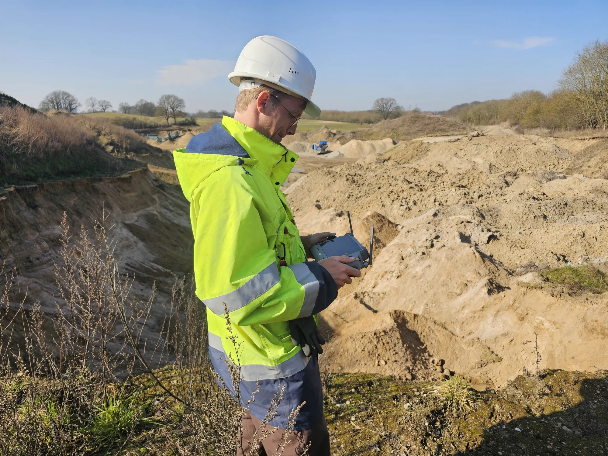
We offer this as a service: drone surveying & aerial survey — across the entire DACH region, with local pilots. Flight incl. processing typically €1,200–2,500, fixed-price quote within two working days.
→ To the service: drone surveying & stockpile survey by drone
3. Ultrasonic. The cheapest level sensor — one point, one echo, one distance.
- Strengths: Price. Entirely sufficient for a small silo with a flat material surface.
- Weaknesses: A single point says almost nothing about volume once cones, bridging or build-up appear. Dust attenuates the echo; temperature layering distorts the time-of-flight reading. Range is limited.
- Fits when: small silos, homogeneous material, a point-level alarm rather than a true volume is required.
4. Radar (1D and 3D). The rugged choice for point or surface measurement — radar penetrates dust with almost no signal loss.
- Strengths: Largely unaffected by dust, vapour and build-up on the antenna. 1D radar is the standard for single silo levels; 3D radar systems produce coarse surface profiles even in extremely dusty bunkers.
- Weaknesses: Spatial resolution. A 3D radar delivers a few dozen measurement points per surface; a 3D LiDAR resolves the same surface with hundreds of thousands. For zone balances, FIFO aging or block models, radar resolution is not enough. The detailed comparison: LiDAR vs. radar.
- Fits when: extreme dust (active filling in a closed silo), simple geometry, a fill level rather than a block model.
The 3D alternative to the point probe: OWL EYE® BUNKERS & FEEDERS — 3D level measurement for silos & bunkers: the complete surface instead of a single height, ±1 %, contactless and dust-resilient.
→ See the solution: 3D level measurement for silos & bunkers
5. Belt scale. Strictly a mass measurement, not a volume measurement — but the benchmark it all gets compared against in every process-measurement tender.
- Strengths: Direct mass measurement, certifiable — for custody-transfer weighing often the only permissible solution.
- Weaknesses: Drift from material build-up, mechanical wear, calibration downtime. And it only measures throughput at one point — it never sees the stock in the yard.
- Fits when: certified billing weight is mandatory. When adding or switching pays off: LiDAR vs. belt scale.
The wear-free alternative to the belt scale: OWL EYE® VOLUME FLOW — conveyor volume flow measurement: ±1 %, no moving parts, belt load and height profile included.
6. Stationary 3D LiDAR. Permanently mounted sensors above the pile, the belt or inside the bunker — continuous point clouds, turned into volume, tonnage and a block model in real time. How it works step by step: LiDAR stockpile measurement in five steps.
- Strengths: The only method combining 24/7 operation with high spatial resolution: ±1% volume accuracy, every pile individually, zones and aging (FIFO) traceable, values delivered via REST, OPC UA or a SAP interface straight into the ERP. No recurring cost per measurement — the marginal cost of one more scan is zero.
- Weaknesses: Upfront investment (sensors plus installation), and sensors need line of sight — under permanent heavy dust right at the discharge point, radar wins. For a single annual inventory a fixed installation is oversized; there, a terrestrial laser scan as a service is the more economical answer.
- Fits when: the stock figure is needed continuously — inventory monitoring, process control, load-out, FIFO. That is exactly what we built OWL EYE® STOCKPILE (piles) and OWL EYE® VOLUME FLOW (conveyors) for.
The decision logic in four questions.
- How often do you need the figure? Once a year → surveyor or scan service. Monthly, outdoors → drone. Hourly or live → stationary LiDAR.
- Indoors or outdoors? Inside buildings, drone and GNSS are largely ruled out; stationary LiDAR and terrestrial scanning remain.
- How much dust? Dust only while filling → LiDAR with timed measurement windows. Permanent dense dust → radar, accepting the resolution trade-off.
- Is a level enough, or do you need a volume? A single point is not a volume. As soon as cones, multiple zones or aging matter, there is no way around full-surface 3D measurement.
Our honest bottom line. There is no best method — only the right one per task. For the rare point-in-time inventory, a fixed LiDAR installation is too much; for continuous stock monitoring with ERP integration it is, in our experience across 40+ industrial sites, the only method without structural compromises. If you are unsure which case is yours: 15 minutes with our engineering team usually settles it faster than three vendor presentations — even if the answer turns out to be "a drone is enough for you". More fundamentals: Why LiDAR for bulk materials and the FAQ from the field.
Comparing complete systems rather than methods? See stockpile monitoring systems compared — fixed LiDAR, drone, SLAM, radar and manual survey side by side.
Wer die Volumenmessung von Schüttgut ausschreiben will, findet sechs grundverschiedene Verfahren — und sechs Anbieter-Gruppen, die jeweils ihres für das einzig richtige erklären. Wir bauen selbst LiDAR-Systeme und haben trotzdem ein Interesse an einem ehrlichen Vergleich: Ein Kunde mit der falschen Technologie ist in zwei Jahren ein unzufriedener Kunde. Hier ist die Übersicht, die wir uns am Anfang selbst gewünscht hätten.
Die Ausgangsfrage ist nie „welche Technologie", sondern „welche Aufgabe". Drei Fälle muss man auseinanderhalten: die Stichtags-Inventur (einmal im Quartal oder Jahr, hohe Genauigkeit, Audit-tauglich), das kontinuierliche Bestandsmonitoring (jede Schicht, jede Stunde, live ins ERP) und die Prozessmessung (Volumenstrom auf dem Band, Füllstand im Bunker, in Echtzeit in die Steuerung). Die meisten Fehlkäufe entstehen, weil eine Technologie aus dem einen Fall in einen anderen verkauft wird.
Das bauen wir: OWL EYE® STOCKPILE — kontinuierliche Volumenmessung von Schüttgut mit stationärem 3D-LiDAR. ±1 % Genauigkeit, 24/7, jede Halde live im Dashboard — ohne Drohne, ohne Vermesser, ohne Stillstand.
→ Zur Lösung: OWL EYE® STOCKPILE — Halden-Monitoring in Echtzeit
1. Manuelle Vermessung (Tachymeter, GNSS-Lauf, Schrittmaß). Der Klassiker der Haldenvermessung zur Jahresinventur. Ein Vermesser läuft die Halde ab oder misst Profile.
- Stärken: Kein Invest, etabliert, von Wirtschaftsprüfern akzeptiert. Für zwei Halden einmal im Jahr schwer zu schlagen.
- Schwächen: Die Genauigkeit hängt an der Messtechnik: Schrittmaß und einfache Profilmessungen weichen bei zerklüfteten Halden schnell 5–15 % ab — mit moderner 3D-Messtechnik ist dagegen ±1 % Standard: Ein terrestrischer Laserscanner erfasst die Halde komplett von wenigen Aufstellpunkten mit freier Sicht — erhöht am Rand, von oben oder, wo es die Geometrie verlangt, auch von der Halde selbst (so machen wir es in der Schüttgut-Inventur als Dienstleistung). Es bleibt aber eine Stichtagsmessung: Das Ergebnis liegt Tage später vor, und zwischen zwei Messungen ist der Bestand blind.
- Passt, wenn: wenige Halden, seltene Messung, kein Live-Bedarf.
2. Drohnen-Photogrammetrie / Drohnen-LiDAR. Ein Überflug erzeugt ein 3D-Modell des ganzen Lagerplatzes.
- Stärken: Große Außenflächen in einem Durchgang, Genauigkeit bei gutem Referenzpunkt-Netz im Bereich 1–3 %, anschauliche Ergebnisse.
- Schwächen: Wetterabhängig (Photogrammetrie zusätzlich tageslichtabhängig), in Hallen praktisch nicht einsetzbar, Flugerlaubnis und Pilot nötig. Vor allem: Es bleibt eine Stichtagsmessung — zwischen zwei Flügen sieht niemand den Bestand, und jeder Flug kostet erneut. Wer wöchentlich statt quartalsweise misst, vervielfacht die laufenden Kosten.
- Passt, wenn: großer Außen-Lagerplatz, monatliche oder quartalsweise Inventur reicht. Der ausführliche Vergleich: LiDAR vs. Drohne.
Das bieten wir als Service: Drohnenvermessung & Drohnenbefliegung — im gesamten DACH-Raum, mit Piloten vor Ort. Befliegung inkl. Auswertung typisch 1.200–2.500 €, Festpreis-Angebot in zwei Werktagen.
→ Zum Service: Drohnenbefliegung & Haldenvermessung per Drohne
3. Ultraschall. Der günstigste Füllstandssensor — ein Punkt, ein Echo, ein Abstand.
- Stärken: Preis. Für einen kleinen Silo mit ebener Schüttung völlig ausreichend.
- Schwächen: Ein einzelner Messpunkt sagt bei Schüttkegeln, Brückenbildung oder Anbackungen fast nichts über das Volumen. Staub dämpft das Echo, Temperaturschichtungen verfälschen die Laufzeitmessung. Reichweite begrenzt.
- Passt, wenn: kleine Silos, homogenes Material, Grenzstand statt Volumen gefragt.
4. Radar (1D und 3D). Die robuste Punkt- oder Flächenmessung — Radar durchdringt Staub praktisch verlustfrei.
- Stärken: Unempfindlich gegen Staub und Dampf, weitgehend tolerant gegen Anbackungen am Sensor. 1D-Radar ist der Standard für einzelne Silo-Füllstände; 3D-Radar-Systeme erzeugen grobe Oberflächenprofile auch in extrem staubigen Bunkern.
- Schwächen: Räumliche Auflösung. Ein 3D-Radar liefert einige Dutzend grobe Messpunkte pro Oberfläche, ein 3D-LiDAR erfasst Hunderttausende pro Sekunde. Für Zonen-Bilanzen, FIFO-Alterung oder Blockmodelle reicht die Radar-Auflösung nicht. Der Detailvergleich: LiDAR vs. Radar.
- Passt, wenn: Extremstaub (aktive Befüllung im geschlossenen Silo), simple Geometrie, Füllstand statt Blockmodell.
Die 3D-Alternative zur Punkt-Sonde: OWL EYE® BUNKERS & FEEDERS — 3D-Füllstandsmessung für Silo & Bunker: die komplette Oberfläche statt einer einzelnen Höhe, ±1 %, berührungslos und staubresistent.
5. Bandwaage. Streng genommen keine Volumen-, sondern eine Massemessung — aber in jeder Ausschreibung der Vergleichskandidat für die Prozessmessung.
- Stärken: Direkte Massemessung, eichfähig — für abrechnungsrelevante Wägung oft die einzige zulässige Lösung.
- Schwächen: Drift durch Materialaufbau, mechanischer Verschleiß, Kalibrier-Stillstände. Sie misst außerdem nur den Durchsatz an einem Punkt — den Lagerbestand sieht sie nie.
- Passt, wenn: geeichte Abrechnung gefordert ist. Wann sich Ergänzung oder Wechsel rechnet: LiDAR vs. Bandwaage.
Die verschleißfreie Alternative zur Bandwaage: OWL EYE® VOLUME FLOW — Volumenstrommessung am Förderband: ±1 %, keine beweglichen Teile, Bandbelegung und Höhenprofil inklusive.
6. Stationäres 3D-LiDAR. Fest montierte Sensoren über der Halde, dem Band oder im Bunker — kontinuierliche Punktwolken, daraus Volumen, Masse und Blockmodell in Echtzeit. Wie das Schritt für Schritt funktioniert: Volumenmessung von Schüttgut mit LiDAR in fünf Schritten.
- Stärken: Die einzige Methode, die Dauerbetrieb und hohe räumliche Auflösung verbindet: ±1 % Volumengenauigkeit, jede Halde einzeln, Zonen und Alterung (FIFO) nachvollziehbar, Werte per REST, OPC UA oder SAP-Schnittstelle direkt im ERP. Keine wiederkehrenden Kosten pro Messung — ob einmal täglich oder einmal pro Minute gemessen wird, der Betrieb kostet dasselbe.
- Schwächen: Invest vorab (Sensorik + Montage), Sensoren brauchen Sichtverbindung — bei sehr starkem Dauerstaub direkt am Abwurf gewinnt Radar. Für eine einzige Jahresinventur ist ein Festsystem überdimensioniert; da ist der terrestrische Laserscan als Dienstleistung wirtschaftlicher.
- Passt, wenn: der Bestand laufend gebraucht wird — kontinuierliche Haldenvermessung, Schüttgut-Monitoring, Prozesssteuerung, Verladung, FIFO. Genau dafür haben wir OWL EYE® STOCKPILE (Halden) und OWL EYE® VOLUME FLOW (Förderband) gebaut.
Die Entscheidungslogik in vier Fragen.
- Wie oft brauchen Sie den Wert? Einmal im Jahr → Vermesser oder Scan-Dienstleistung. Monatlich außen → Drohne. Stündlich oder live → stationäres LiDAR.
- Innen oder außen? In Hallen scheiden Drohne und GNSS weitgehend aus; stationäres LiDAR und terrestrischer Scan bleiben.
- Wie viel Staub? Sichtbehinderung nur bei Befüllung → LiDAR mit Messfenstern. Permanenter dichter Staub → Radar, mit bewusstem Verzicht auf Auflösung.
- Reicht ein Füllstand oder brauchen Sie ein Volumen? Ein Punktwert ist kein Volumen. Sobald Schüttkegel, mehrere Zonen oder Alterung eine Rolle spielen, führt an flächiger 3D-Messung nichts vorbei.
Unser ehrliches Fazit. Es gibt keine beste Methode — es gibt die passende pro Aufgabe. Für die seltene Stichtags-Inventur ist LiDAR als Festinstallation zu viel; für kontinuierliches Bestandsmonitoring mit ERP-Anbindung ist es nach unserer Erfahrung aus 40+ Industriestandorten die einzige Methode ohne strukturelle Kompromisse. Wenn Sie unsicher sind, welcher Fall Ihrer ist: 15 Minuten mit unserem Engineering klären das meist schneller als drei Anbieter-Präsentationen — auch wenn am Ende „Drohne reicht bei Ihnen" herauskommt. Mehr Grundlagen: Warum LiDAR für Schüttgut und die FAQ aus der Praxis.
Sie vergleichen komplette Systeme statt Methoden? Siehe Systeme zur Haldenüberwachung im Vergleich — stationäres LiDAR, Drohne, SLAM, Radar und manuelle Vermessung nebeneinander.
Kto specyfikuje pomiar objętości hałd i materiałów sypkich, natrafia na sześć zasadniczo różnych metod — i sześć obozów dostawców, z których każdy ogłasza swoją jako jedyną rozsądną. Sami budujemy systemy LiDAR, a mimo to zależy nam na uczciwym porównaniu: klient na złej technologii to nieszczęśliwy klient dwa lata później. Oto przegląd, który sami chcielibyśmy dostać na początku.
Pytaniem wyjściowym nigdy nie jest „która technologia", lecz „jakie zadanie". Warto rozróżnić trzy przypadki: inwentaryzacja na daną chwilę (kwartalnie lub rocznie, wysoka dokładność, jakość audytowa), ciągły monitoring zapasów (każda zmiana, każda godzina, na żywo do ERP) i pomiar procesowy (strumień objętości na taśmie, poziom napełnienia w zbiorniku, czas rzeczywisty do systemu sterowania). Większość złych zakupów bierze się stąd, że technologię z jednego przypadku sprzedano do innego.
To właśnie budujemy: OWL EYE® STOCKPILE — ciągły pomiar objętości materiałów sypkich stacjonarnym LiDAR-em 3D. Dokładność ±1 %, 24/7, każda hałda na żywo w pulpicie — bez drona, bez geodety, bez przestoju.
→ Zobacz rozwiązanie: OWL EYE® STOCKPILE — monitoring hałd w czasie rzeczywistym
1. Pomiar klasyczny (tachimetr, obchód GNSS, kroki). Klasyka rocznej inwentaryzacji. Geodeta obchodzi hałdę lub zdejmuje profile.
- Mocne strony: Brak nakładów inwestycyjnych, metoda od dawna ugruntowana, akceptowana przez audytorów. Dla dwóch hałd raz w roku trudna do pobicia.
- Słabe strony: Dokładność zależy od techniki pomiaru: kroki i proste profile rozrzucają się o 5–15 % na nieregularnych, poszarpanych hałdach — przy nowoczesnym pomiarze 3D standardem jest ±1 %: naziemny skaner laserowy obejmuje całą hałdę z kilku stanowisk z czystą linią widzenia — podwyższonych na obrzeżu, z góry albo, gdzie wymaga tego geometria, z samej hałdy (tak realizujemy naszą usługę inwentaryzacji materiałów sypkich). Pozostaje to jednak pomiarem na daną chwilę: wyniki przychodzą po dniach, a między dwoma pomiarami zapas jest niewidoczny.
- Pasuje, gdy: mało hałd, rzadki pomiar, brak wymogu danych na żywo.
2. Fotogrametria z drona / LiDAR na dronie. Jeden nalot daje model 3D całego placu.
- Mocne strony: Duże tereny otwarte za jednym przelotem, dokładność 1–3 % przy dobrej osnowie naziemnej, wyniki zrozumiałe dla każdego na pierwszy rzut oka.
- Słabe strony: Zależność od pogody (fotogrametria dodatkowo wymaga światła dziennego), praktycznie bezużyteczna wewnątrz budynków, wymaga wyszkolonego pilota i, zależnie od przestrzeni powietrznej, zgody na lot. Najważniejsze: pozostaje pomiarem na daną chwilę — między dwoma nalotami nikt nie widzi zapasu, a każdy nalot kosztuje od nowa. Pomiar co tydzień zamiast co kwartał mnoży koszt cykliczny.
- Pasuje, gdy: duży plac na otwartym terenie, wystarcza inwentaryzacja miesięczna lub kwartalna. Pełne porównanie: LiDAR vs dron.
Oferujemy to jako usługę: pomiary dronem i naloty fotogrametryczne — w całym regionie DACH, z lokalnymi pilotami. Nalot wraz z opracowaniem typowo 1 200–2 500 €, oferta ze stałą ceną w ciągu dwóch dni roboczych.
3. Ultradźwięki. Najtańszy sensor poziomu — jeden punkt, jedno echo, jedna odległość.
- Mocne strony: Cena. W zupełności wystarczające dla małego silosu z płaską powierzchnią materiału.
- Słabe strony: Pojedynczy punkt mówi o objętości prawie nic, gdy tylko pojawią się stożki, mostkowanie lub narosty. Pył tłumi echo; uwarstwienie temperatury zniekształca pomiar czasu przelotu. Zasięg jest ograniczony.
- Pasuje, gdy: małe silosy, jednorodny materiał, potrzebny alarm poziomu, a nie prawdziwa objętość.
4. Radar (1D i 3D). Wytrzymały wybór do pomiaru punktowego lub powierzchniowego — radar przenika pył niemal bez strat sygnału.
- Mocne strony: W dużej mierze niewrażliwy na pył, parę i narosty na antenie. Radar 1D to standard pojedynczych poziomów w silosach; systemy radarowe 3D dają zgrubne profile powierzchni nawet w skrajnie zapylonych zbiornikach.
- Słabe strony: Rozdzielczość przestrzenna. Radar 3D dostarcza kilkadziesiąt punktów pomiarowych na powierzchnię; LiDAR 3D rozdziela tę samą powierzchnię setkami tysięcy. Dla bilansów strefowych, starzenia FIFO lub modeli blokowych rozdzielczość radaru nie wystarcza. Szczegółowe porównanie: LiDAR vs radar.
- Pasuje, gdy: skrajny pył (aktywne napełnianie zamkniętego silosu), prosta geometria, potrzebny poziom napełnienia, a nie model blokowy.
Alternatywa 3D dla sondy punktowej: OWL EYE® BUNKERS & FEEDERS — pomiar poziomu 3D dla silosów i zbiorników: cała powierzchnia zamiast pojedynczej wysokości, ±1 %, bezdotykowo i odpornie na pył.
→ Zobacz rozwiązanie: pomiar poziomu 3D dla silosów i zbiorników
5. Waga taśmowa. Ściśle biorąc pomiar masy, nie objętości — ale to punkt odniesienia, z którym wszystko jest porównywane w każdym przetargu na pomiar procesowy.
- Mocne strony: Bezpośredni pomiar masy, możliwość legalizacji — dla ważenia w obrocie handlowym często jedyne dopuszczalne rozwiązanie.
- Słabe strony: Dryft od narostów materiału, zużycie mechaniczne, przestoje na kalibrację. I mierzy tylko przepływ w jednym punkcie — nigdy nie widzi zapasu na placu.
- Pasuje, gdy: legalizowana masa rozliczeniowa jest obowiązkowa. Kiedy opłaca się dołożyć lub zmienić: LiDAR vs waga taśmowa.
Bezzużyciowa alternatywa dla wagi taśmowej: OWL EYE® VOLUME FLOW — pomiar strumienia objętości na przenośniku: ±1 %, bez części ruchomych, obciążenie taśmy i profil wysokości w komplecie.
→ Zobacz rozwiązanie: pomiar strumienia objętości na przenośniku
6. Stacjonarny LiDAR 3D. Sensory zamontowane na stałe nad hałdą, taśmą lub wewnątrz zbiornika — ciągłe chmury punktów, przetwarzane w czasie rzeczywistym na objętość, tonaż i model blokowy. Jak to działa krok po kroku: pomiar hałd za pomocą LiDAR w pięciu krokach.
- Mocne strony: Jedyna metoda łącząca pracę 24/7 z wysoką rozdzielczością przestrzenną: dokładność objętości ±1 %, każda hałda z osobna, strefy i starzenie (FIFO) identyfikowalne, wartości dostarczane przez REST, OPC UA lub interfejs SAP wprost do ERP. Brak cyklicznych kosztów pomiaru — koszt krańcowy kolejnego skanu wynosi zero.
- Słabe strony: Inwestycja początkowa (sensory plus instalacja), a sensory potrzebują linii widzenia — przy trwałym, gęstym pyle bezpośrednio przy punkcie wysypu wygrywa radar. Dla pojedynczej rocznej inwentaryzacji instalacja stacjonarna jest przewymiarowana; tam bardziej ekonomiczną odpowiedzią jest naziemny skaning laserowy jako usługa.
- Pasuje, gdy: stan zapasów potrzebny jest w sposób ciągły — monitoring zapasów, sterowanie procesem, załadunek, FIFO. Dokładnie po to zbudowaliśmy OWL EYE® STOCKPILE (hałdy) i OWL EYE® VOLUME FLOW (przenośniki).
Logika decyzji w czterech pytaniach.
- Jak często potrzebna jest liczba? Raz w roku → geodeta lub usługa skaningu. Co miesiąc, na zewnątrz → dron. Co godzinę lub na żywo → stacjonarny LiDAR.
- Wewnątrz czy na zewnątrz? Wewnątrz budynków dron i GNSS w dużej mierze odpadają; pozostają stacjonarny LiDAR i skaning naziemny.
- Ile pyłu? Pył tylko podczas napełniania → LiDAR z czasowymi oknami pomiarowymi. Trwały, gęsty pył → radar, z akceptacją kompromisu rozdzielczości.
- Wystarczy poziom czy potrzebna objętość? Pojedynczy punkt to nie objętość. Gdy tylko liczą się stożki, wiele stref lub starzenie, nie ma drogi obok pełnopowierzchniowego pomiaru 3D.
Nasze uczciwe podsumowanie. Nie ma metody najlepszej — jest tylko właściwa dla danego zadania. Dla rzadkiej inwentaryzacji na daną chwilę stacjonarna instalacja LiDAR to za dużo; dla ciągłego monitoringu zapasów z integracją ERP jest, według naszego doświadczenia z ponad 40 zakładów przemysłowych, jedyną metodą bez kompromisów strukturalnych. Jeżeli nie są Państwo pewni, który przypadek jest Państwa: 15 minut z naszym zespołem inżynierskim zwykle rozstrzyga to szybciej niż trzy prezentacje dostawców — nawet jeżeli odpowiedź brzmi „wystarczy Państwu dron". Więcej podstaw: Dlaczego LiDAR do materiałów sypkich oraz FAQ z praktyki.
Porównują Państwo kompletne systemy, a nie metody? Zob. porównanie systemów monitoringu hałd — stacjonarny LiDAR, dron, SLAM, radar i pomiar klasyczny obok siebie.
Want to discuss this topic or share your own experience? Email info@sachtleben-technology.com — we always reply. Möchten Sie über dieses Thema sprechen oder Ihre Erfahrung teilen? Schreiben Sie an info@sachtleben-technology.com — wir antworten immer. Chcą Państwo omówić ten temat lub podzielić się własnym doświadczeniem? Proszę napisać na info@sachtleben-technology.com — zawsze odpowiadamy.